The Appalachian Trail Conservancy has a flickr photostream, including a set of the southbound 2010 thru-hikers. But not us; Someday didn't get her picture taken, and I did but I may not have listed myself as 'thru-hiker', or maybe my picture just wasn't cool enough.
Tuesday, December 14, 2010
Monday, December 13, 2010
Zippers
Jo asked, and now I have the answer: my gear featured 8.12m (26' 7.7") of zippers.
   Item                      Length:  metric    imperial   decimal percent of total

Total                                 8.12m     26' 7.7"   1.00***
   Fleece Vest                        1.00m     3' 4.2"    0.13*
      Front                           68.00cm   2' 2.8"    0.08*
      2x Pockets                      34.00cm   1' 1.4"    0.04*
   Sleeping Bag Liner Pouch           17.00cm   6.7"       0.02
   Sleeping Bag                       1.00m     5' 7.3"    0.21**
   REI eVent Rain Shell               1.00m     3' 3.6"    0.12*
      2x Side                         17.50cm   6.9"       0.02
      Front                           67.00cm   2' 2.4"    0.08*
      Sternum                         16.00cm   6.3"       0.02
   Lens Pouch (Tamrac)                23.00cm   9.1"       0.03
   Sierra Designs Light Year 1 Tent   2.00m     7' 9.7"    0.29**
      Rain Fly                        94.00cm   3' 1.0"    0.12*
      Door                            1.00m     4' 8.7"    0.18*
   REI Sahara Pants                   36.50cm   1' 2.4"    0.04*
      Fly                             15.00cm   5.9"       0.02
      Hip Pocket, Interior            7.50cm    3.0"       0.01
      Back                            14.00cm   5.5"       0.02
   Pack                               1.24m     4' 0.8"    0.15*
      Side Pocket                     23.50cm   9.3"       0.03
      Floating Top Pocket             25.00cm   9.8"       0.03
         Outside                      25.00cm   9.8"       0.03
      J-Zip                           56.50cm   1' 10.2"   0.07*
      Hip Mesh Pocket                 19.00cm   7.5"       0.02
(The above is the output of a modification of the mass-computation script I threw together before leaving — feel free to play with zippers.py. If there's interest — mine or others' — I may even make it into a web page.)
(P.S. From the Wikipedia article on Inch, consulted for the ever-necessary 2.54: "Effective July 1, 1959, the United States and countries of the British Commonwealth defined the length of the international yard to be exactly 0.9144 meters.[1] Consequently, the international inch is defined to be equal to exactly 25.4 millimeters. This creates a slight difference between the international units and surveyor's units which are described in the article on the foot." Just in case it was too simple.)
Thursday, December 9, 2010
Epilogue: Springer to Gainesville to Berwyn
From the summit, we walked back down the 0.9mi to the parking lot. There, my Uncle2 Bob and Aunt Pat picked us up and drove us back out along the forest roads to civilization. We stayed at a house they have and are working on remodeling, where their daughter Janet lives; we had a relaxing and fun evening there (Janet fixed us all dinner). The next day we visited Mark of the Potter (Uncle Bob and Aunt Pat are retired potters; I have done some pottery), and then stopped in at Uncle Bob and Aunt Pat's retirement community, Lanier Village, for tourism and dinner, before getting on the train.
Uncle Bob was telling us about a young woman who worked at Lanier Village, who we quickly realized was Flora — small world, still! Unfortunately she wasn't there (word on the street was: making up a hundred missed miles in New York — in December), so we couldn't surprise her by showing up, but we left a note.
Jo and I had the same train (overnight) from Gainesville to D.C., but then we parted ways: I had a couple more hours and then some commuter rail to home in Berwyn (at my mom's), whereas she had to wait out the balance of a 50-hour trip (including some visits with friends during layovers).
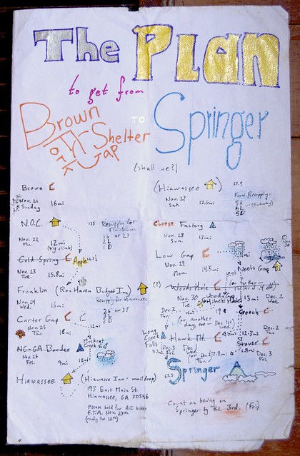
Despite being anti-plan most of the trip, we stuck to our end-of-journey plan pretty well — at least, we got to Springer on the 3rd (our projected later date), and stayed at a fair number of the places we'd mapped out. There were some alterations, and some varations considered.
 |
 |
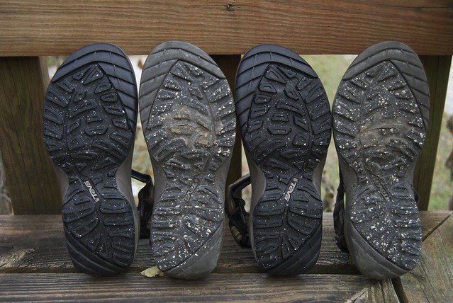
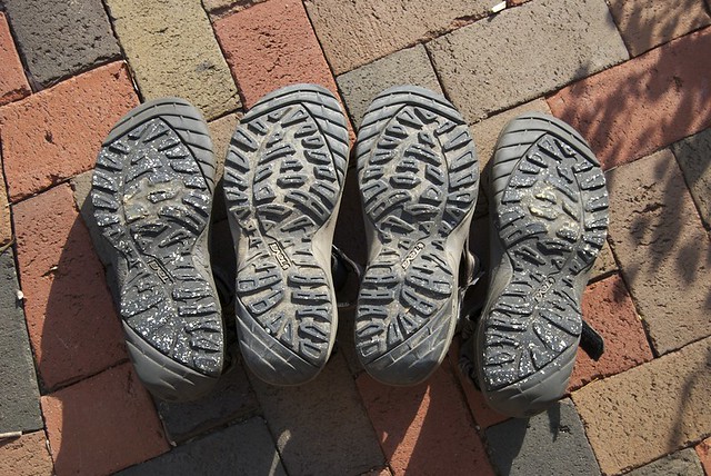
And, I did put a little more wear on my Tevas (both pairs, but mostly the new ones). Above, at the N.O.C.; below, safely home in Berwyn.
Neel's Gap to Springer
The last stretch! (Or, the last half of the last stretch, going by resupplies.)
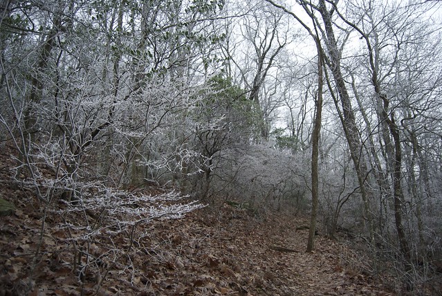
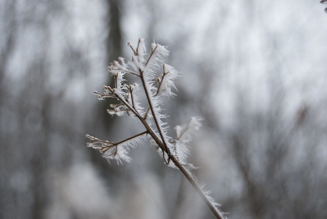
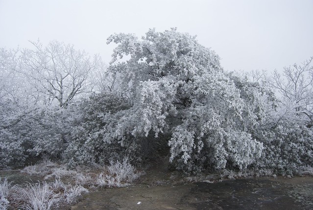
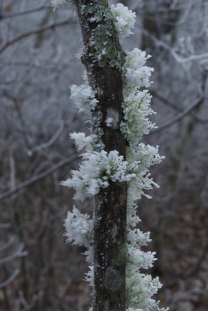
We had another frozen morning heading out from Neel's Gap; I think the thermometer read 24°F outside, at the hostel. Another day of rime ice and frost going over Blood Mountain — which is higher than Springer at 4,458ft (v. 3,780), and thus to me our last hurrah — stunningly gorgeous surroundings, if physically numbing.
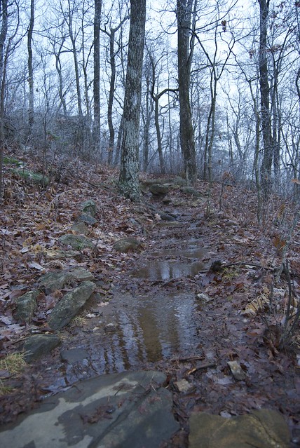
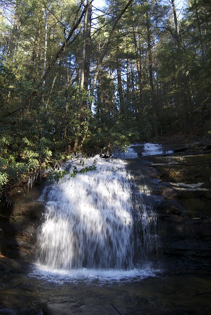
Some of the water — at lower elevations — was not frozen.
(I had to remind myself to hike more and admire less when my fingers got too numb to work the camera buttons.)

No views — or, no views except of clouds. It did make me a little nervous to walk under that tree, coated so heavily in ice. (Surprisingly, despite seeing lots of downed trees from earlier rainstorms, I didn't notice any branches that the ice had felled.)
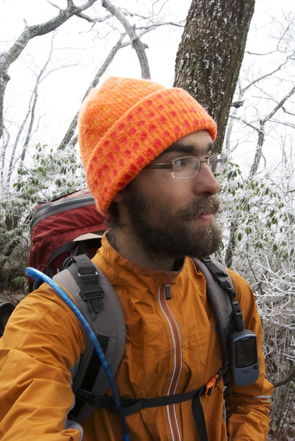
Despite my best efforts, minimal ice on the beard. (However, going over Blood Mountain was the only time my reservoir hose froze.)
Back in the sun and warm.
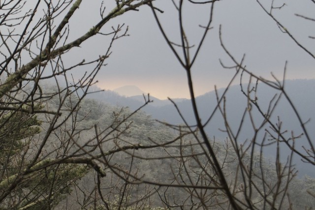
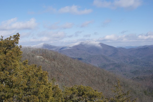
Blood Mountain, seen from south along the A.T.
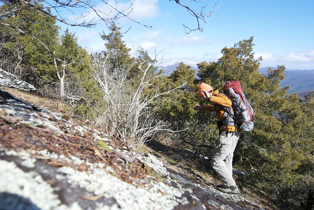
Risking life and limb for photography.
At Woody Gap, we called Hiker Hostel (run by Josh and Lee). We had only done a half day (ten or eleven miles), but the shuttle from Woody Gap was free, as opposed to significant cost if we went a few more A.T. miles; and a warm night at a recommended hostel seemed like the way to go. (It still left us with a reasonable if long 17-miler the next day, and one last night out.)
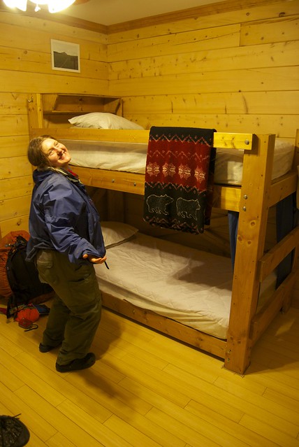
Bunks — with not just pillows, but curtains. We stayed in the Colorodo Trail room, featuring the owners' photography from the same.
Downstairs, we raided the movie collection, and ate popcorn and (ordered in) pizza. (Runaway Bride and Shakespeare In Love, interspersed with intelligence from an A.T. names book about why it's called "Dismal" and who Mr. Suffered Alone was anyway.)
In the morning, we breakfasted in the main dining area (waffles! grits! eggs!) before heading out.
I made a side trip, on Josh's recommendation, to one last fire tower.
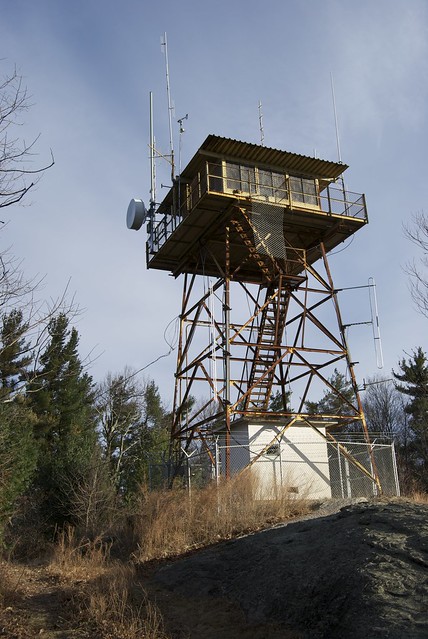
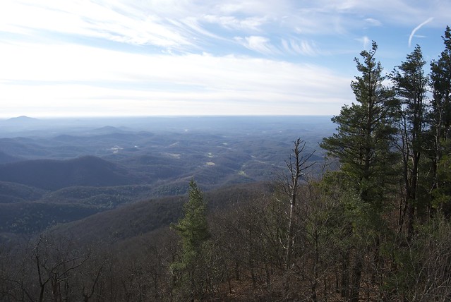
Again, the upper deck was locked (and full of equipment), but the stairs afforded a nice view.
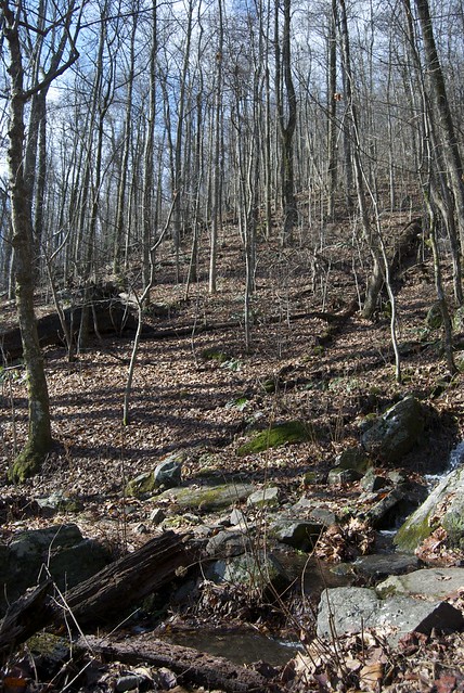
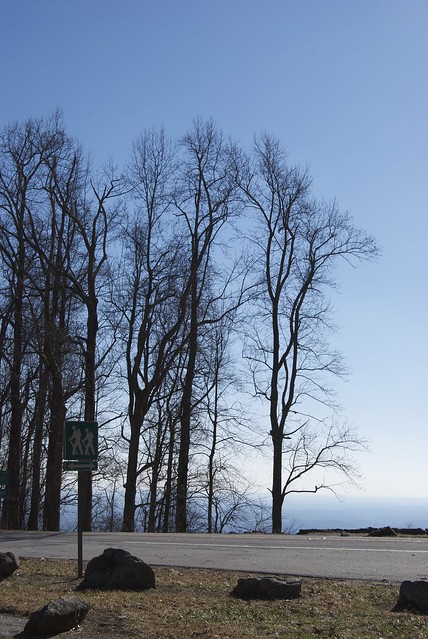
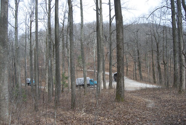
Most of the rest of the trail was fairly flat — a few bumps to climb over, but nothing taxing compared to previous terrain — and we criss-crossed forest roads. (This is the only traffic I saw.)
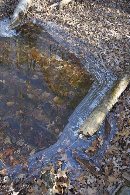
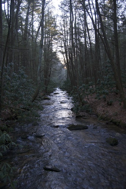
Seepage and temperature, finely balanced.
I found Jo's bandana on the sign to Long Creek Falls; she was hiking ahead and, in keeping with tradition, had left it as a sign that she was stopping there (at least temporarily).
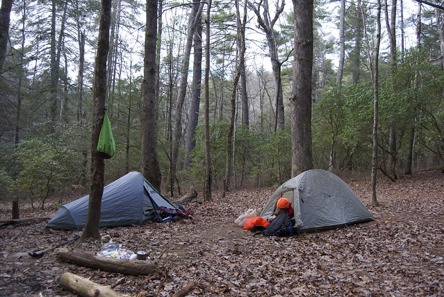
We decided to camp nearby. We weren't too far from the shelter, but wanted the evening to ourselves, and didn't mind the extra warmth our tents would provide. (It turned out to be very cold indeed — an all-layers night.) Another everyday occurence: Jo had eaten and was in her sleeping bag by the time I started cooking — helped in this case that she'd mailed her stove and pot home in Hiawassee, and had minimal preparation needed for dinner.
Breakfast, summit morning. (I think this is the last of the squished donuts being eaten.)

The A.T. crossed and sometimes shared tread with the Benton MacKaye trail (blazed with white diamonds). Not necessarily coincidentally, it also was ridiculously wide some of the way (but did not seem to be a troad, as it narrowed going, for example, around corners.).

The note on the sign post echoes a sentiment we frequently felt: "Give Proper Directions South So People Don't Walk In A Circle." (Nearby there was a branch in the trail with nary a southbound blaze visible; at the Blood Mountain shelter, the A.T. (southbound from the shelter) followed the privy's blue-blaze — without, of course, a matching white blaze. Ed, with whom we shared Low Gap Shelter, told us that on the IAT they're referred to as "reassurance markers", which seems like a perfectly apt name.)
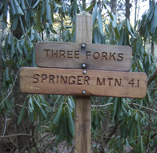
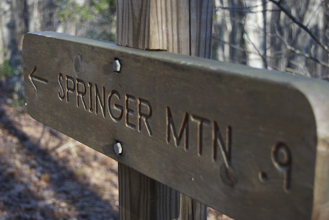
Closing in! (This is just past the parking area where we later met my relations.)
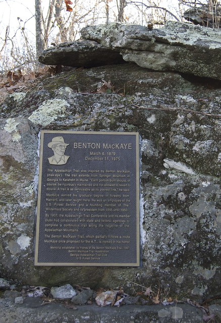
I took another mini detour (up along the Benton MacKaye trail) to a memorial for its creator.
...and there we were! My reaction was 'oh wait, is this The Rock With The Plaque?' It is not a summit to impress, but it does fine as a journey's end.
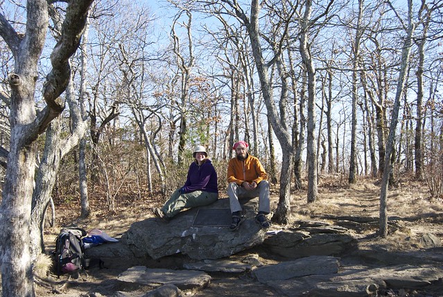
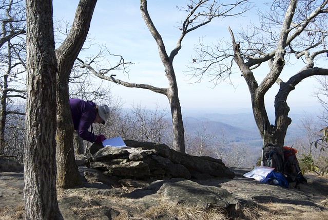
There is a bit of a view (as well as a register in a little metal cabinet under the rock).
We hung about and took a plethora of victory photos. Eventually — we had passed an empty parking lot on the way up — day hikers arrived, too.
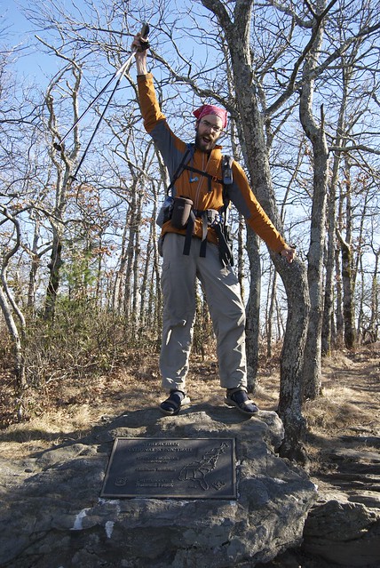
The symbolic end of any great journey needs bubbles.

Subscribe to:
Posts (Atom)